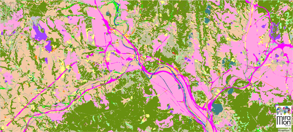
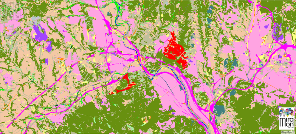
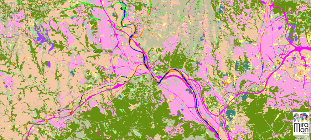
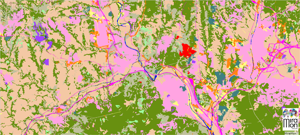
The Land Cover Map of Catalonia
4a edition of The Land Cover Map of Catalonia
Raster format by sheets of the 4a edition of MCSC
3rd edition of The Land Cover Map of Catalonia
Raster format by sheets of the 3rd edition of MCSC
2nd edition of The Land Cover Map of Catalonia
Raster format by sheets of the 2nd edition of MCSC
1rst edition of The Land Cover Map of Catalonia
Raster format by sheets of the 1rst edition of MCSC
Vizualize MCSC
Navigator of The Land Cover Map of Catalonia
About the MCSC
The Land Cover Map of Catalonia (MCSC) is a high-resolution thematic cartography of the main types of land cover (forests, crops, urbanized areas, etc.). The MCSC is held at the Center for Ecological Research and Forestry Applications (CREAF), with funding from the Generalitat de Catalunya.
The MCSC is part of the Cartography available on the internet of the Generalitat de Catalunya and is, therefore, free to use.
The MCSC is presented in digital format. The different surfaces are made by photointerpretation and digitization on a computer screen, using the GIS MiraMon .
Downloads
Raster format by sheets of the 1rst edition of MCSC (images)
Coverage areas of Catalonia (1rst edition MCSC)
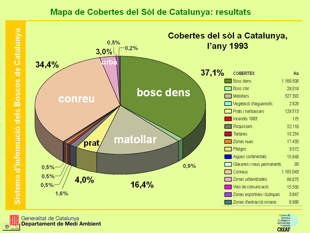
Summary of results (1rst edition) (jpg format)
Principal features (1rst edition) (pps format)
Results and application (1rst edition) (pps format)
Raster format by sheets of the 3rd edition of MCSC, version 1 (images)
Vector format by sheets of the 3rd edition of MCSC, version 2 (polygons)
Raster format by sheets of the 3rd edition of MCSC, version 2 (images)
Principal features (3rd edition) (pps format) (20 Mb)
Results (3rd edition) (format pps ) (33 Mb)
Summary of characteristics and results (3rd edition) (pdf format) (3 Mb)
Cartography navigator
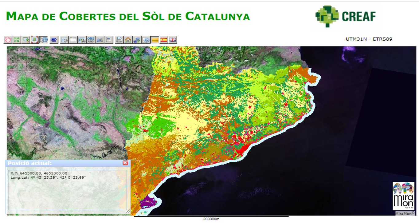
Map navigator that includes the 4 editions of MCSC , as well as the five-year series (1987 to 2017) of Map of Covers and Uses of Land of Catalonia developed fear the Department of Geography of the UAB. It also contains other information of interest such as the layers of the "Biophysical Variables" and Orthophotos (both the current one and the historical series) at 1: 25,000, 1: 5,000 and 1: 2,500 of ICGC scales.
Browser developed with MiraMon technology. Browser updated on 10-15-2020.