 |
| |
| Land Cover Map of
Catalonia Vector format (polygons), 3rd edition version 2 (2005-2007) |
||
Attention:
We strongly recommend updating
MiraMon Map
Reader if your version has been installed before june 2000
| |
Land Cover Map 3rd edition version 2 is a review of 3rd edition version 1. Changes have been done in order to adapt MCSC 3rd edition to fit new categories on 4th and to correct detected errors. |
| To download data | |
|
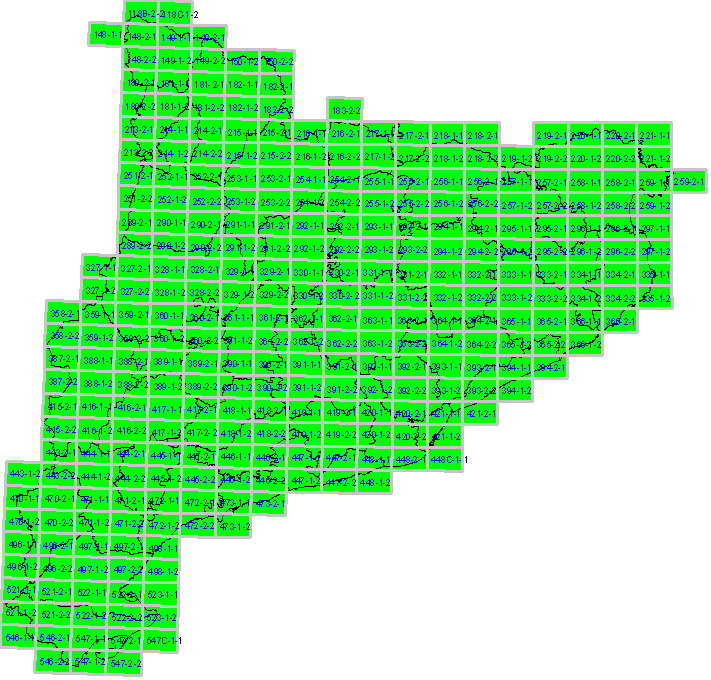
Click on the Map below, in the area of the map you want
to download; you can also donwload and save files
into your computer by clicking the right mouse button (files size is
between 400KB and 9.000KB)
NOTE: Please take into account that MCSC 3rd edition, as previous editions, does not include the bridges of Road and Railway Network, and the lowest land cover is the one referred. Nevertheless, this edition gather all the bridges together in a separate vector to enable their integration a posteriori, as can be done for MCSC by administrative units. Bridges vectors can be downloaded here. ATTENTION: Colour Orthoimages 1:5000 for the period 2005-2007 provided by ICC (Institut Cartográfic de Catalunya ) have been used as base material for Land Cover Map 3rd edition. In some cases, however, some polygons of certain sheets have been adjusted to fit 2005 SPOT-5 images due to specific requirements for SIOSE project (Land Cover and Use Information System of Spain) in Catalonia.. |
| |
|
Reference
Cartography |
other
available formats DXF SHAPE KMZ |
 |
|
 |
|

