 |
| |
| Land Cover Map of
Catalonia Vector format (polygons), 4th edition (2009) |
||
Attention:
We strongly recommend updating
MiraMon Map
Reader if your version has been installed before june 2000
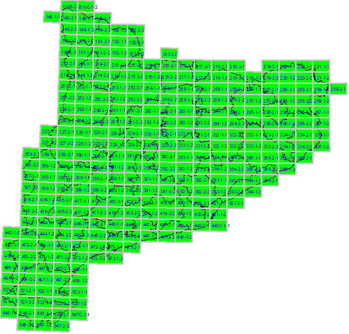
| To download data | |
| Click on the Map below, in the area of the map you want
to download; you can also donwload and save files
into your computer by clicking the right mouse button (files size is
between 400KB and 10.000KB) NOTE: Unlike MCSC previous editions, 4th edition incorporate the bridges of Road and Railway Network, so the upper land cover is the one referred. |
| |
| |
Download MCSC data: |
 |
|
 |
|
|
Rasters 3rd edition version 2 (images) |
|
Rasters 4th edition (images) |
| |
|
| |
|
| Vectors 3rd edition version 1 (polygons) | |
|
Vectors 3rd edition version 2 (polygons) |
|
Reference
Cartography |
other available formats DXF SHAPE KMZ |
 |
|
 |
|