Land analysis
Shaded Relief Map
Overlaying a thematic map (Land Cover Map) over a shaded relief map
Outline
This section shows how to overlay thematic layers over shaded releif maps so as to make maps which give us a sort of a 3D vision of the thematic layer as it distributes over the territory. Even though this is not an exercise in territorial analysis per se and what we obtain is a final product in terms of a map with high quality visual effects, territorial analysis techniques are used to obtain it. We will use the Land Cover Map of Catalonia, elaborated by CREAF (see page)
The idea is to obtain a map with a 3D effect that contains information on spatial distribution of the land's cover. With the correct GIS tools we can do these kinds of operations. The end result is a very attractive, graphically powerful map showing the distribution of land cover over the relief. The map contains not only information on spatial distribution of these uses, but also their orographic position.
Criteria
To make a shaded relief map with the Land Cover Map, the following information layers must be available:
- · Digital Elevation Model
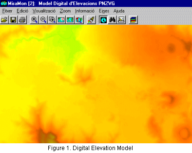
Figure 1 shows the Digital Elevation Model (MDE) for area of Croscat and Santa Margarida volcanoes. The MDE gives us information on the altitude of each point in the territory. Highlighting this data with color shading gives us the impression of a "relief" pattern.
- Digital Illumination Model
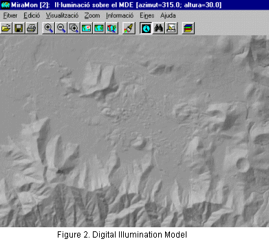
For a given position of the sun, and for all points in the territory, we can calculate the amount of light they receive, according to orientation and slope. On this occasion, we calculate the model for a fictitious position of the sun (315º azimuth in relation to the north). This position has been widely used in other traditional cartographic productions, since this is the easiest way to appreciate the relief pattern. A "normal" position of the sun, for example at noon (180º azimuth) gives an end effect of inverted relief, in which most users see crests as valleys and valleys as crests.
- Digital Shading Model
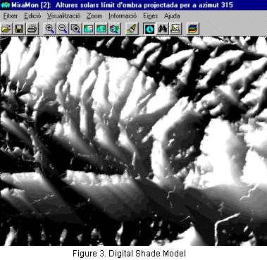
The Digital Shading Model, calculated for a certain position of the sun, lets us identify which points in the land are shaded; therefore, we can find out at that particular moment whether they receive direct sunlight or not.
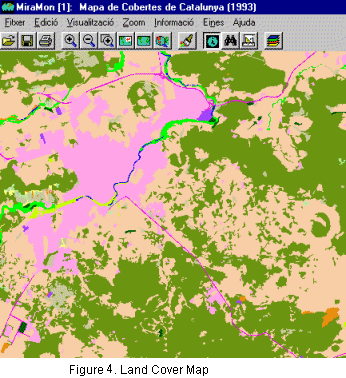
- Land Cover Map
Finally, we need the graphical layer that we want to show in relief. In our case, this is the land cover map in raster format.
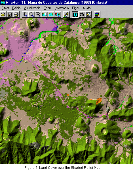
Using the digital illumination and shade models we can apply a process to the land cover map whereby each color of the palette is modified in intensity in order to make it look like a pattern in relief. For example, the areas of shaded evergreen oak forests are displayed in a deeper (darker) green than an evergreen oak forest in an area with sunlight (light green). This is what makes it look like as it were in relief. We could say that we incorporate relief information into the coverage map.
Solution
Using the previous data, the shading process is applied to the land cover map by means of a specific GIS MiraMon application. The results are shown in the following figure:
Open this shaded relief map using MiraMon.