Land Analysis
Vulnerability Maps
Making a Vulnerability Map for the Park, according to Various Layers of Information
Outline
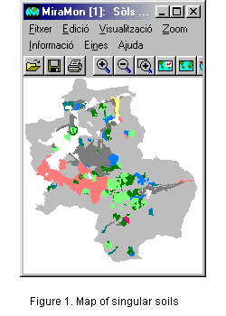
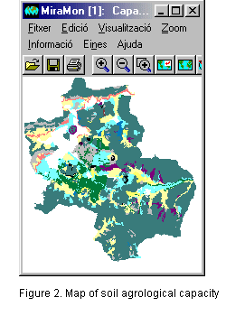
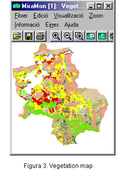
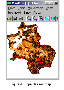
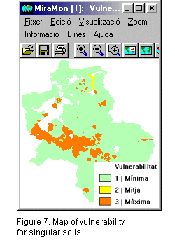
This example shows how to make vulnerability maps from different layers of thematic information and following certain predetermined criteria. The end result of the exercise depends entirely upon the criteria selected initially; therefore, the results we will see are only one of many possibilities. The thematic layers used are the singular soils map, agrological capacity map, vegetation map, slope map, map of altitudinal classes and lithological map. The vulnerability map was made by giving equal weight to all these layers. In the resulting map, the contribution by each thematic layer is the same in relation to the decision made on the level of vulnerability in a certain area, even though it is possible, if so desired, to give these different factors different weights (importance). For example, in the final result, the same weight is given to an area with sharp slopes as to an area with a special oak forest or one with d'andosoils. Obviously, if one area had all three factors, its vulnerability would be classified as maximum.
Initial data
Initial sources of data:
|
|
|
|
|
|
Criteria
For this exercise, the following criteria are used:
Solution
First of all, we will create individual vulnerability maps for each layer in which the analysis is based.
|
Maximum vulnerability (3) Andosoil on pyroclasts Andosoil on massive volcanic rocks Average vulnerability (2) Alfisoil on massive volcanic rocks Low vulnerability (1) Non-unique soil Mollisoil on pyroclasts Inceptisoil on pyroclasts Entisoil on pyroclasts Mollisoil on massive volcanic rocks Inceptisoil on massive volcanic rocks |
 |
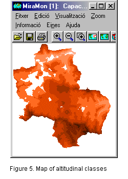
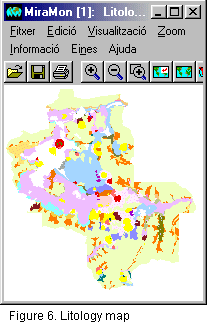
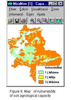
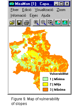
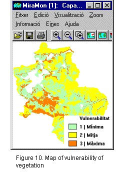
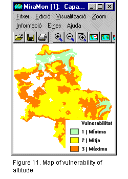
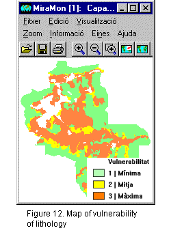
With similar reclassification processes, we generate vulnerability maps for the remaining thematic layers: agrological capacity, classes of slope, vegetation, altitude and lithology.
 |
 |
 |
 |
 |
|
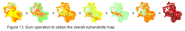
The next step is to obtain a joint vulnerability map using the sum of the different individual vulnerability maps.
 |
Finally, if we want to obtain 3 end classes of vulnerability, we need to reclassify the map resulting from the previous sum in order to obtain the final vulnerability map.
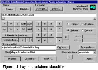 |
Reclassification >>> | 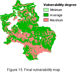 |
By means of a graphical layer calculator/reclassifier, we can generate vulnerability maps for certain areas. The final layer, the vulnerability map, depends entirely on the criteria used. Any change in the initial criteria can considerably vary the end result. In this case, we have seen as an example a simple case for making vulnerability maps using various initial thematic layers.