Land analysis
Environmental Impact Assessment
Impact of the Route N-260 Expansion Project on Land Cover
Outline
This exercise will show the procedure to be followed in order to evaluate the environmental impact of a certain infrastructure. In this case, we will evaluate only the extent to which the land cover is affected by the roadwork. We have taken the example of the expansion project for route N-260 between Montagut and Olot. We would like to point out that the results of this exercise are not the real results because the affected area we are using is just a simplification of the real area. (In order to see the exact figures regarding effects on each land cover type, we would have to use the real perimeter of road affected, as per each section's typology, and this information was not available at the time this CD-ROM was made.)
We want to find out what types of land covers are affected by the project, and what their absolute and relative areas are.
Initial data
Initial sources of data:
|
|
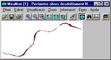
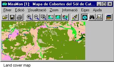
| Perimeter of the roadwork in the route N-260 expansion project | Land Cover Map of Catalonia (CREAF) |
Criteria
The criteria we will use in this evaluation are as follows:
Solution
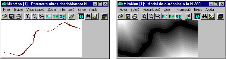
| The first step is to obtain the digital model of distances to the roadwork on route N-260. This procedure is carried out by MiraMon's distance calculation program. | This picture shows a digital model of distances to the roadwork on route N-260. The shading from black to white indicates increases in the distance to the road. Each of the values in the raster cells has represents the distance from the cell to the road in meters. | ||||||||||||||||||||||||||||||||||
 |
|||||||||||||||||||||||||||||||||||
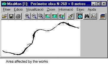
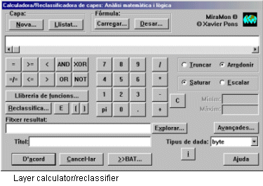
| Once we have the digital model of distances, we reclassify the layer in order to obtain the entire area around the roadwork that lies at a distance less than or equal to 8 meters. We take 8 as the number of meters affected by the roadwork at either side of the same. Using the MiraMon layer Calculator/Reclassifier, we assign the value of 0 to all cells having a distance greater than 8 meters, and the value of 1 to all cells having a distance less than or equal to 8 meters. The result is a mask of the road's affected area. | |||||||||||||||||||||||||||||||||||
 |
|||||||||||||||||||||||||||||||||||
| Having obtained the mask corresponding to the affected area, we make a combination of layers using MiraMon's layer Combinator. This program analyzes the spatial intersection of the categories of two layers generating a new raster and/or report (in TXT or CSV [spreadsheet] format) with tables of statistics for these intersections. | |||||||||||||||||||||||||||||||||||
|
|
||||||||||||||||||||||||||||||||||
 |
|||||||||||||||||||||||||||||||||||
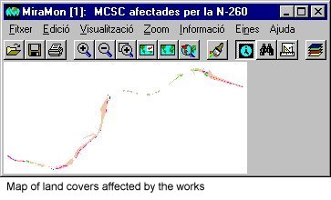
| Finally, by means of a simple multiplication operation of the map resulting from the combination of layers by the mask corresponding to the affected area, we obtain a final land cover affected. | |||||||||||||||||||||||||||||||||||
 |
 |
||||||||||||||||||||||||||||||||||
| As a result, MiraMon's layer Combinator also gives us a report on the statistical intersection between layers for all categories. Below we highlight the part of the report that interests us, which is the areas affected by types of land cover. | |||||||||||||||||||||||||||||||||||
|
|||||||||||||||||||||||||||||||||||