Park Management
Forest Management
Outline
Forest management in the 'Zona Volcŕnica de la Garrotxa' Natural Park is divided into three main tasks: monitoring the evolution of the Park's forests, making mandatory forest reports and writing up and evaluating Forest Management Plans In order to optimize the Natural Park's financial and human resources, with the assessment of the Center for Ecological Research and Forestry Applications, a strategy was drawn up for forest information management. This strategy allows the efforts dedicated to any of the three aforementioned divisions to benefit the other two. This means we need information on the forests that allows us to deal with all three jobs at once, without having to have specific information available for each one of them. For example, information retrieved from the field for a mandatory forest report must also serve to evaluate a Forest Manatement Plan and vice-versa.
For a more detailed description, see the corresponding article.
Goal and objectives
The goal of this module is to set up the design and implementation for forest data management in a way that fulfills the needs for the three tasks at the same time --monitoring the Park's forests, writing mandatory forest reports and writing and evaluating Forest Management Plans-- thus optimizing the resources that the Natural Park dedicates to forest management within its territory.
The objectives to be attained are:
Design and Implementation
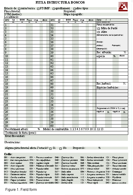
In the first place, a standardized field form was designed in order to do forest inventories (Figure 1). This form serves to obtain information in a homogenous, coherent way in order to respond to the three aforementioned main objectives.
In order to position the forest plots for sampling, a conventional point grid was chosen (a type of sampling that is habitual in Forest Management Plans and in forest-cut reports) which can be increased in density up to one plot per hectare. This progressively increased density sampling allows for data to be obtained in accordance with the evaluation of its variance. This is how we determine the point at which no more sampling is necessary, and in this way we avoid collecting more information than the strictly necessary.
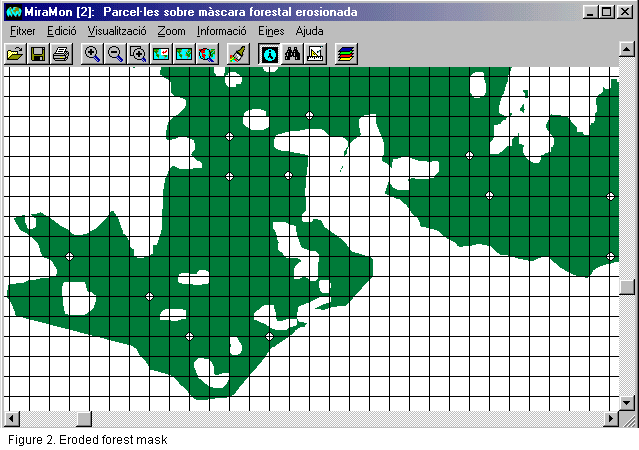
Location of the plots is based upon the land cover map of Catalonia, from which a forest mask is drawn up. This forest mask is later eroded (Figure 2) at the edges of the forested areas, in order to avoid as far as possible having plots located at the limits of the Park's forests. In fact, the intent is to avoid their being near the edges.
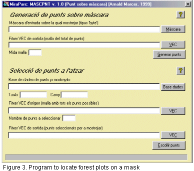
Plots are automatically placed with the help of an application specifically developed for this task (Figure 3). The application randomly places them on the forest mask, with care being taken not to repeat plots that have already been measured and that are included in the field database.
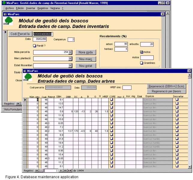
Once the fieldwork has been done and the field forms are filled (Figure 1) data entry is begun on the field database by means of the maintenance form (Figure 4).
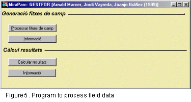
A program has been developed (Figure 5) to process all field data and create a structured layer of points with the processed field data linked to each point, where each point represents a measured forest plot. This same program generates a field form in HTML format for each plot measured, so that within the same layer of points, we have access to the processed forest data as well as the field data in HTML format.
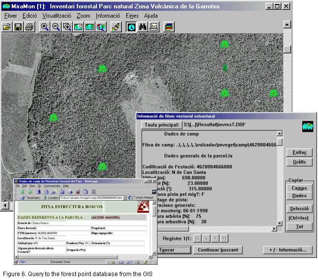
The end result we obtain, then, is a layer of structured points linked to forest data for each of the inventoried plots, with a link to the field form in HTML format (see Figure 6). All this information is therefore accessible and can be analyzed from the GIS environment and from the MiraBosc forest data analysis program.