Land analyisis
Land use change evaluation
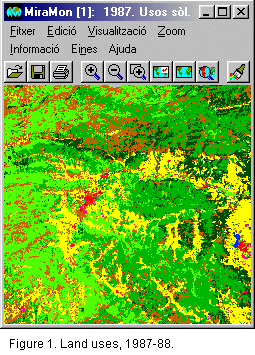
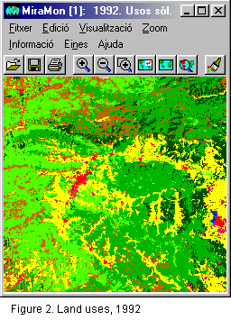
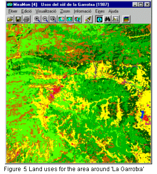
Changes in Land Use in La Garrotxa over the 1988-1992 period
Outline
This example shows how to make an analysis of the changes in land use for a certain region of the territory, in this case 'La Garrotxa county'. Specifically, an evaluation is made of the changes in land use throughout the county and the directions taken by same. This will give us, for each type of use of land existing in 1988, the proportion in which it has become each type of use of land present in 1992.
Initial data
Initial sources of data:
|
|
|
Criteria
For this exercise we will use the following criteria:
Resolution
The steps to be followed are as follows:
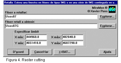
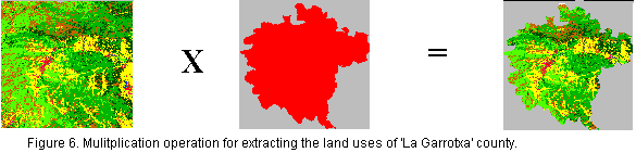
First of all, we obtain the uses of land in 1988 and 1992, only for the Garrotxa area. This step is advisable in order to reduce the volume of data processed and, consequently, the speed of the entire process. In order to carry out this operation, we use the MiraMon raster cutting tool.
 |
 |
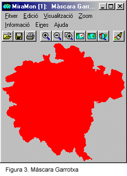
Next we select only the portion of the map within 'La Garrotxa' limits. For this operation, we use the Garrotxa limits in the form of a mask. Using a simple multiplication operation, we send all pixels outside the county to the value of NODATA, which will mean the exclusion from the operations of the areas that are outside the county lines. This step must be taken on both the 1988 and 1992 maps.
 |
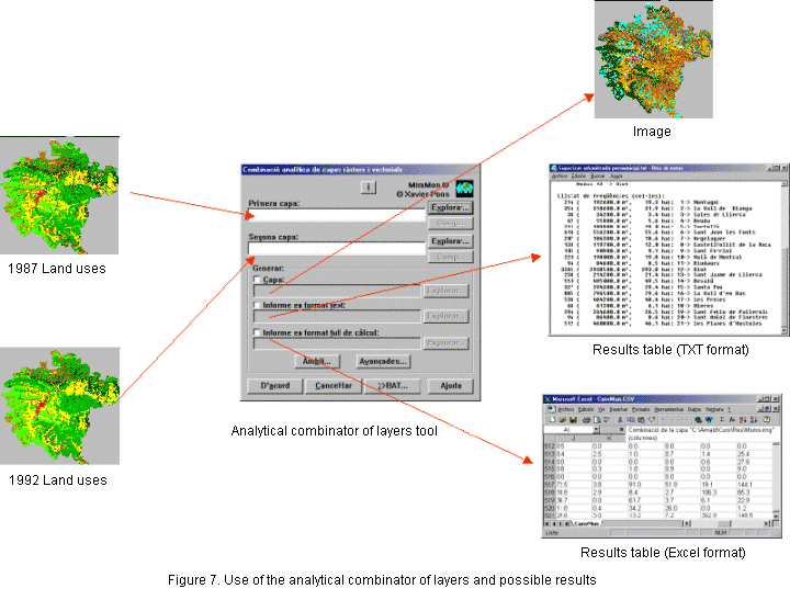
Once the two graphical layers corresponding to land uses strictly within La Garrotxa county have been prepared, we analytically combine the two layers of information. For this operation, we use the MiraMon analytical combination tool. As a result we obtain an image, a report in text format and a report in EXCEL® format.
 |
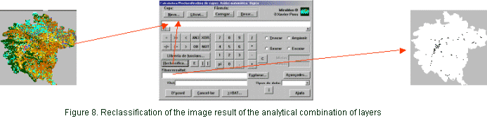
Using the image created and the reports made, we can find out what changes in land use have been produced. For example, we can find in which land use types of 1992 the areas that in 1988 were croplands have been converted. We could find out what land uses underwent greater development processes. If we are interested in the latter case, a simple reclassification will give us a map indicating all areas in the county that have been developed during this period (Fig. 8).
 |